An Insider’s Guide to Bermuda: Walking the Railway Trails
Operating from 1931 to 1948, the railway served as transportation for thousands of Bermudians on the 22-mile-long rail.
In 1920, there were no cars, trucks, buses or railroads in Bermuda. To travel from place to place, Bermudians used horse drawn carts and carriages, boats, and bicycles. Banned in 1908, motorized vehicles were, at the time, unfavorably viewed by Bermudians who thought automobiles would scare their horses and make them unfit for work. American tourists, who purposely came to the island to escape the noise and pollution of the city, also agreed with the ban. Since Bermuda was called the “Isles of Rest,” bringing any motorized vehicles to the peaceful island would disrupt this well earned moniker. Even author Mark Twain joined in on the ban of motorcars. He advocated this ban and also helped draft the legislation. These combined efforts helped the Bermuda House of Assembly ban all private motor vehicles under The Motor Car Act of 1908 which was in effect until 1946.
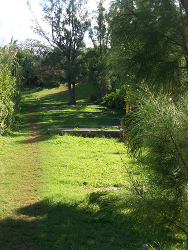
Remnants of the old concrete support beams can be seen in the image above
By 1945 the railroad was in disarray, structural problems combined with crushing debt and dismal maintenance forced the government to hire a firm of American engineers to study the railroad and consult on its future. By April of 1946, faced with the estimated cost of almost $1 million dollars to repair and almost $2 million to convert it into a highway, the decision was made to close the railroad forever and allow motor vehicles to travel on the roads of Bermuda.
In 1984, the Bermuda Government transformed almost 18 miles of the original 22 miles of railway into a scenic trail for both walkers and cyclists alike. While sections of the railway trail are paved, most of the trail is not. The trail is not recommended for wheelchair users (both motorized and non-motorized) or for those who walk with crutches. There is a risk of sunburn and heat exhaustion from May to October, so use care when heading out. On the railway trails, the breathtaking views, tranquility, open water, and flora and fauna are unparallelled by anywhere else in the world. To capture the landscape, be sure to bring along a camera or video recorder.
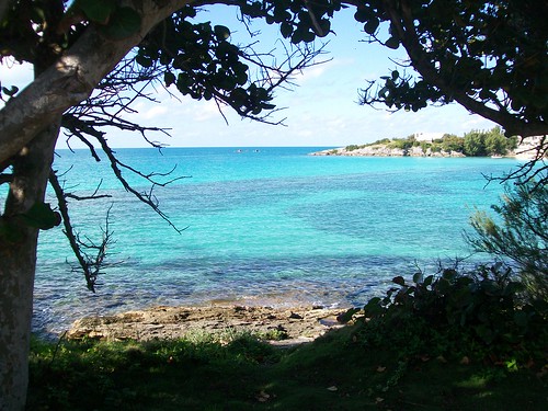
Beautiful views await you on the railway trail.
The modern railway trail is divided into seven sections as shown on the interactive map below for your convenience.
View Railway Trail in a larger map
Section 1 (blue)– A two-mile long stretch from east of the Somerset Bus Terminal to Somerset Bridge.
Section 2 (red) – From Somerset Bridge to Frank’s Bay. This section includes Evan’s Bay and George’s Bay.
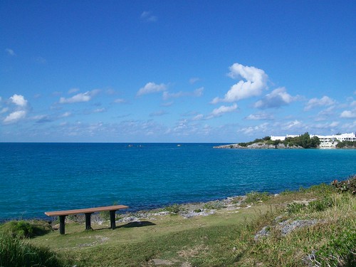
Stop to rest along the trail and enjoy the scenery
Section 3 (green)– Starts at Seymour’s Pond where Middle Road meets Bay View Drive. Gibbs Hill Lighthouse is included in this section.
Section 4 (pink) – Starting near the Southampton Princess Hotel at the intersection of Middle Road and Music Height. This long section ends at the intersection of South Shore Road and Bellevue Drive right before the roundabout at East Broadway at the start of Hamilton proper.
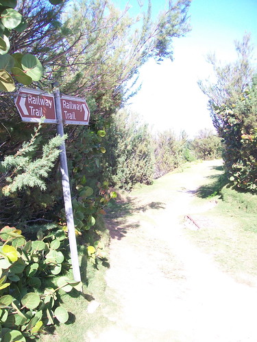
Bermuda's Railway Trail covers 18 of the original 22 miles of railroads
Section 5 (yellow) – Begins at the junction of North Shore Road and Palmetto Road in Devonshire Parish and joins up with a mile long stretch in Smith’s Parish. This continues until you cross North Shore Road where you will find the remnants of the bridge that crossed the mouth of the Flatts Inlet.
Section 6 (dark purple) – Encompasses Hamilton Parish starting at the opposite side of the Flatts Inlet until it ends along Coney Island Road and North Shore Road. This section includes beautiful views of North Shore, the former Railroad Museum and Shelly Bay.
Section 7 (light blue) – Starting at Ferry Reach in St. George’s Parish until it’s end at Suffering Lane is the final section of the railway trail. Here you will find the old Astor estate. American tycoon Vincent Astor, son of John Astor who perished on the Titanic, who was a major benefactor of the Bermuda Aquarium, built his estate on the South Shore of Ferry Reach in the 1930’s. On his estate he built, with the help of Baldwin Locomotive, a railway trail with 2 small carriages that carried himself and his guests to his own railway station until the closing of the railroad in 1948. Upon his death, the estate was sold off and the railroad disbanded on his grounds.
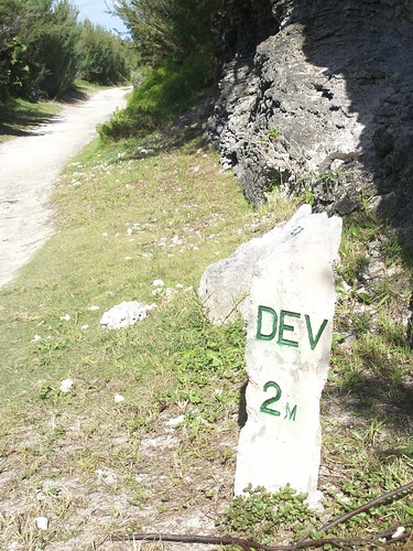
Parish mile marker along trail
Today, the railroad can best be seen as captured by artist Mr. John Finch. Mr. Finch, a retired engineer from the United Kingdom, paints scenes of the railroad that are historically accurate and emotionally moving. They represent a time in Bermuda’s history that was the end of an era and the beginning of the modern world arriving to the “Isles of Rest”.
Lindsey Lehman is the Bermuda Editor for Wandering Educators
All photos courtesy and copyright Lindsey Lehman
-

- Log in to post comments


