History Comes Alive in Old San Juan
Where in North America can you celebrate five centuries of history? From now until June 2022, Puerto Rico is celebrating the 500th anniversary of the founding of Old San Juan. Established by the Spaniards in 1521, Old San Juan has the distinction of being “the oldest continuously inhabited post-European contact city under United States territory and the second oldest in the entire Western Hemisphere.”

As cruise ship passengers, we were introduced to the walled city when our Celebrity ship entered the harbor. Our port side balcony offered spectacular coastal views of segments of the walled city. With a mid-afternoon disembarkation, our time was limited. Had we not visited during the pandemic, we may have considered taking the free white trolley from the port. Instead, we swiftly walked uphill on the narrow cobblestone streets so that we could reach the San Juan National Historic Site—Castillo San Cristobal and Castillo San Felipe del Morro or El Morro—before they closed at 4:30 pm. These two fortifications are separated by a 20–30-minute walk and are the oldest European structures under the sovereignty of the US, and one of the oldest in the Americas.
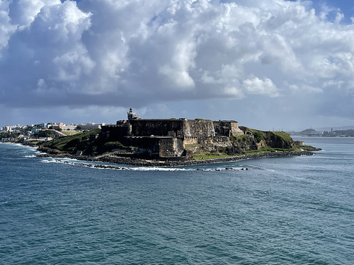
Entering the port of San Juan by cruise ship
During our walk in the Old San Juan Historic District, we saw many centuries’ old buildings and examples of Spanish colonial, Gothic Renaissance, and Baroque architecture. Reconstruction efforts from the latest hurricane were evident on many of the narrow streets.
Overview
During the Age of Exploration (1400s to 1600s), the European sailing ships followed the ocean currents and trade winds to the Caribbean Islands. Puerto Rico became known as the “the gateway to the New World” or the “front door to the Caribbean” because it was the first large island with fresh water and a useful harbor that the Europeans encountered after leaving Europe.
Christopher Columbus came to Puerto Rico during his second voyage, and called it San Juan Bautista. Later, the island was renamed Puerto Rico, which means rich port. Juan Ponce de Leon chose to create a colony in 1508 and displace the native Taino Indians. The result was the annihilation of this indigenous people. Thirteen years later, the settlement was moved to an islet near the harbor entrance, and San Juan city was founded. Spain imported African slaves to help build the city.
To maintain control of the San Juan islet and prevent attacks from the Taino, European adversaries, and pirates, Spain protected the island with a multi-tiered fortification system using a complex system of fortresses and walls. These structures were built and expanded over two and a half centuries. The first stage was started in 1533 and completed in 1540 with La Fortaleza, which means “The Fortress.” Since this building did not ward off attacks, other fortifications were necessary. La Fortaleza was eventually converted into the governor’s house, and is the current official residence of the Governor of Puerto Rico. Had our ship arrived in the morning, we may have taken a guided tour.
The other structures that are part of the San Juan National Historic Site were constructed later. Walls protected the east, south, and west coasts, while steep cliffs were a natural deterrent on the north end. By the beginning of the 16th century, Spain dominated the Caribbean islands, and controlled Puerto Rico from the 16th to the 19th centuries. A series of domestic and international events caused Spain to lose its jurisdiction over its American empire. Mexico, Colombia, Venezuela, Argentina, Peru, and Chile gained their independence in the first few decades of the 19th century. Under the terms of the Treaty of Paris in 1898, Puerto Rico became a U.S. territory at the conclusion of the Spanish-American War. Residents of Puerto Rico became American citizens.
La Perla Ravelin
Along our route, we passed a large sign on a grassy field in front of a segment of the city’s decaying wall. It indicated where a small fort called La Perla or the Pearl was erected to defend the northern side of the city. In the 1700s, this fort was transformed into a ravelin, a military concept referred to as a “defense in depth.” This area was part of a series of barriers and fortifications that were positioned in such a way to allow one place to be fired upon by another location. Today, only a few ruins remain.
Unforeseen Stresses
Another sign explained how the vibrations from car and truck traffic caused the Spanish-built wall to crumble. The original engineers lived during the era of the horse and wagon. They could not have foreseen the effects of modern vehicles.
Castillo San Cristobal or Fuerte San Cristobal
This complex was designed by the Irish-born chief engineer Thomas O’Daly. Both Spain and Ireland had a common enemy: England. Castillo San Cristobal became the largest European fortification in the Americas, covering approximately 27 acres. When construction began in 1634, the intended purpose was to protect the people from a land attack. The project took more than 150 years to complete.
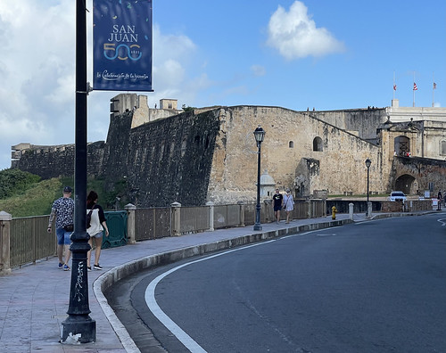
Approaching Castillo San Cristobal
With a limited amount of time, we scampered through the three levels—the main plaza, the main firing battery, and the observation area. Surrounding the main plaza were vaulted rooms called casemates that housed barracks, officers’ quarters, storage areas, a kitchen, and a latrine. We briefly peeked into some of these fortified rooms that had the ability to fire cannons.
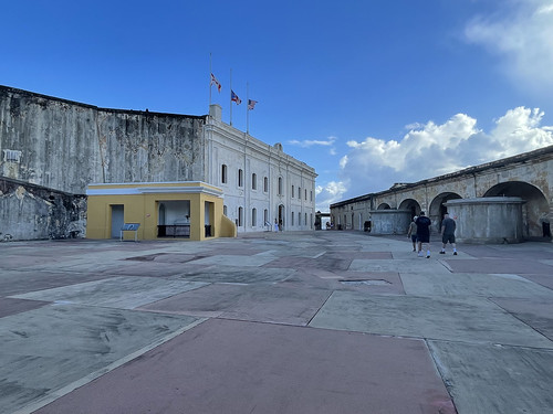
Inside Castillo San Cristobal
Another feature of the fort was three 18th century tunnels that allowed the soldiers to move undetected from one part to another. Water was collected in five enormous masonry cisterns lined with limestone to help keep the water clean. Rainwater was directed from numerous places in the structure to the cisterns, which held approximately 870,000 gallons of water.
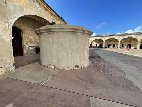
Water Well in San Cristobal
Looking upward, we saw three flags: the Burgundy Cross (the Spanish military flag that flew during most of the Spanish colonial period), the flag of the Commonwealth of Puerto Rico, and the American flag.
On the top level, we took panoramic photos of the modern city. Much of the original city wall was removed in the late 19th century when the city was expanding. The stones were used to fill in part of the harbor so there would be more available land for building.
Numerous efforts have been made to preserve this historical fortress. Environmental factors such as rain, wind, sun, and salt, combined with natural aging, add to the challenges of keeping history alive.

View of the harbor from Castillo San Cristobal
Walk Between the Two Fortresses
We walked on a sidewalk not far from the coastline. Along the way, we passed by remnants of the walled city, the Museo de San Juan, and the Museo de las Americas. Since we wanted to see El Morro, we only had time to take a few exterior images. Hugging the coastline, we saw white gravestones at the Santa Maria Magdalena de Pazzis Cemetery that was used until the beginning of the 19th century. Several small buildings and a lighthouse were on the horizon. In the large field leading up to El Morro, people were taking advantage of the prevailing winds by flying kites, a popular Puerto Rico tradition.

Exterior of Museo San Juan
Castillo San Felipe del Morro or El Morro
A long sidewalk with large grassy fields on both sides separates the adjacent street from El Morro. While looking at this peaceful park, it is challenging to think back to 1625, when hundreds of Dutch and Spanish soldiers lost their lives during a month-long attack.
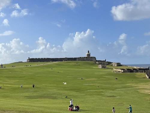
Approaching El Morro
Right before we entered, we came upon a dry moat. The moat was a vital aspect of the fortress’ defense system. When the drawbridge was closed, enemies would need to climb up the walls while under fire.
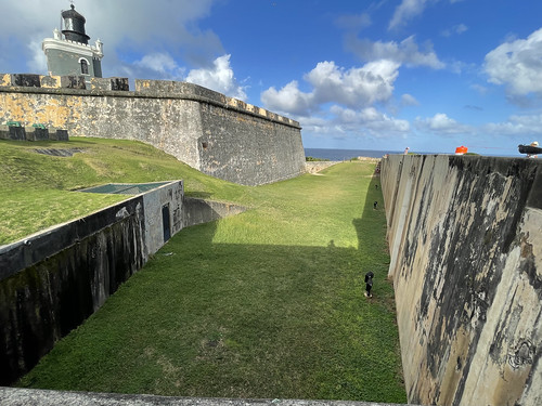
Dry Moat at El Morro
The term El Morro adeptly describes the geography of this notable landmark. It means the headlands, or a high point of land extending into a body of water. The fortress’ primary role was to offer protection from a sea invasion. San Juan was vulnerable since it was the first good port that European sailing ships would spot on their way to the New World. The first stage of fortification began in 1539 with a promontory armed with cannons. By 1790, the compound had six levels: a water battery, the original tower, the lower plaza, the main firing battery, the main plaza, and the land defense on the highest level.
With less than 30 minutes until closing, we stopped for a moment to look at the plaza which was surrounded by vaulted rooms like we had just seen at Fuerte San Cristobal. Our attention was diverted to a wellhead where the soldiers once gathered to draw water from the underground cisterns. Like other visitors, our cameras also focused on the 19th century lighthouse, the oldest on the island.
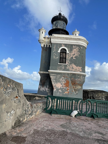
El Morro Lighthouse
As National Park Service personnel were informing visitors of the impending closing time, we bolted up to the top level so we could see the panoramic view. We looked across the channel to a small island called Isla de Cabras, where Fort San Juan de la Cruz, also known as El Cahuelo, was built to create a crossfire with the cannons at El Morro. By the early 1800s, improvements in military technology made this fort obsolete. Today, the land surrounding this historical landmark is accessible by car and is used as a recreational area that offers wonderful views of El Morro and the entrance to San Juan Bay.
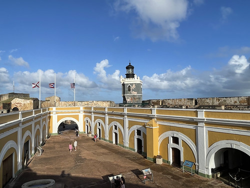
Looking Down on El Morro’s Main Plaza
Before we were ushered out by National Park Service employees, we quickly reflected on the success of this landmark. It had withstood the onslaught of many battles, and, remarkably, was never defeated by any of its adversaries.
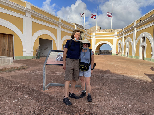
Sandy and Ira inside El Morro
Bastion de las Palmas
A public park has replaced this former strongpoint along the city wall. After the Dutch burned and looted the city in 1625, a bastion was placed at this location to protect the city from future invasions.
Additional Historical Points of Interest
With more than 500 years of history, there are plenty of notable places to see in the historic district. Plaques help identify small gems, as well as larger sites. If you have more than a few hours, consider checking out some of these places.
• Iglesia de San Jose, or San Jose Church, opened in 1532 and showcases the Spanish Gothic architecture of that era.
• Juan Ponce de Leon is buried in a tomb in Bautista Cathedral, another example of medieval Spanish architecture.
• La Casa del Libro is a rare-book library and museum.
• Casa Blanca, or White House Museum, is the former home of Ponce de Leon’s family. It was turned into an historical museum called Museo Casa Blanca. The home was built in 1521 for Juan Ponce de Leon, the first governor of Puerto Rico, but he passed away in Florida before he ever lived in the home that needed to be rebuilt after a fire.
• Museo de las America has both temporary and permanent exhibits and is in the Cuartel de Ballaja, a former Spanish infantry barrack built in the mid 19th century.
• The Puerto Rico Capital building is listed on the United States National Register of Historic Places.
Whether your visit coincides with a Caribbean cruise or a prolonged land vacation, I encourage a stroll through San Juan’s Historic District. As you explore different sites, history will come alive in Old San Juan.
Sandy Bornstein, the History Comes Alive Through Travel Editor for Wandering Educators, has visited more than 40 countries and lived as an international teacher in Bangalore, India. Sandy’s award-winning book, May This Be the Best Year of Your Life, is a resource for people contemplating an expat lifestyle and living outside their comfort zone. Sandy writes about Jewish culture and history, historical sites, family, intergenerational, and active midlife adventures highlighting land and water experiences.
All photos courtesy and copyright Sandy Bornstein


